
POWELL’S OROGENOUS ZONES – A Story of What If…

Does anything say more about the impudence and self-importance of our European forefathers than their belief that politics, economics and the straight lines they imposed would
That’s why many who would never consider living east of the Eisenhower Tunnel see the Four Corners’ right angles as virtual crosshairs on the West…
Atop that (pun intended) those right angles converge, of ALL places, on the Colorado Plateau, home to some of the most twisted, tufted, shunted and cleaved orogeny on the planet. It’s as though the politicians, generals, railroad magnates, and land speculators looked at the region and, to congratulate themselves for their continental conquest, used state lines as ribbon to wrap up the wildest of the West as a present to themselves.
But then again, what more could one expect from a people whose earlier claim to the domain of the West included the farcical “rain follows the plow” Chamber of Commerce blather to encourage settlement (our first realtors!) of a region happy to get a mere foot of precipitation a year.
Ignorance of what the West was even like was the order of the day. At the most fundamental level, the West wasn’t just different than the east, it was opposite: what ran through the region, water, and what was to be found underneath it, minerals, were most important.
Even then, aside from journals and dispatches from everyone from Lewis and Clark to those from military personnel manning outposts, the leaders of the republic in D.C. had only western Europe and the eastern U.S. as a frame of reference. The West in America was as strange and ominous as Shelley’s Arctic haven for Frankenstein, or Darwin’s new science on evolution.
Remember, we were a busy country back then. Victors over various “Indian” tribes (Kit Carson was old and dying), we had repelled the Spanish, French and English. We had Texas!
But the stain of the Civil War remained. Though over, its wounds festered, Exhibit A being John Wesley Powell’s severed left arm, a casualty of the epic battle of Shiloh. And anyone who knows anything about the Colorado River knows about John Wesley Powell. Powell’s trips down the Colorado are forever part of Western lore and legend, but less known is what he proposed in terms of boundary formation in the West, that rivers and watersheds form its boundaries for states and counties. Ten years after his first of two trips, he wrote: “as the Western states were brought into the union they be formed around watersheds, rather than arbitrary political boundaries.” History reminds us that the railroads beat the rivers.
Two weeks- that’s the difference in time between May 10, 1869, when the Golden Spike stitching together the Atlantic and Pacific oceans via railroad at Promontory, Utah (a state named for the Utes driven further west from Colorado) was driven and Powell’s maiden voyage from Castle Rock in the Wyoming Territory on the Green River with nine others to run the Colorado River (six would survive).
The railroad was the final stamp for imposing order on the New Frontier; Washington D.C.’s version of flat earthers prevailed, so Jefferson’s borrowed grid system of townships and sections, i.e. LINES, would stretch from sea to shining sea. Even Summit County, an immense region in the Colorado Territory that made up maybe as much of 20% of Colorado nearly 15 years before statehood, had three straight LONG lines for borders despite the staggering array of mountains and rivers in Colorado’s northwest quadrant.
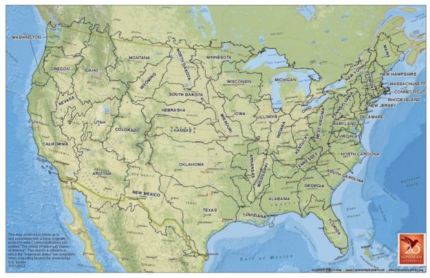
It’s against this backdrop we have a little fun with some revisionist history, an exercise that begins with “what if…?” So what IF Powell’s vision had instead prevailed over the railroads, miners, carpetbaggers and settlers? John Lavey, a land use planner at the Sonoran Institute, shows us a very different West with his map of Powell’s watersheds-as-borders model.
First, such an idea shows individual states separated by serrated mountain ranges and the rivers they spawned to form topographic palisades. Nine rivers, the Grand, Snake, Missouri, Yellowstone, Columbia, Green, and a second tier of lesser rivers, the Sacramento, San Joaquin, and Gila, would have our western states looking far different than they do today.
The careful reader finds no mention of
the Colorado . The main vein of the West was the Grand River until Colorado Congressman Edward Taylor of Glenwood Springs (our first tourist chief!) had it changed in 1921, this despite some from Wyoming and Utah who pointed out that the Green River was longer with a larger drainage basin above its confluence with the Grand. So when banter around the campfire slows, watch eyebrows arch when mentioning the Colorado River is only 100 years old.
Were Powell’s vision to have been implemented, Colorado would have won BIG- more mountains (and thus more water) and NO Front Range. Denver and Cheyenne would be in Kansas, and Grand Junction would have been the natural choice for it’s state capital given its central location (sorry Breckenridge- despite claiming an early post office and ingratiating yourself to the “Establishment” by assuming the name of Vice President John Cabell Breckinridge, the Kingdom would just be too far east for state capital. Same for Leadville, once in contention with Denver for the same claim).
Arizona (now home to Las Vegas), Idaho and Utah gain at the expense of Montana, Wyoming
As for the Plains states, the Mississippi acts as a black hole. The Dakotas, Nebraska, Kansas and Oklahoma are all like the trunks of elephants, thinning eastward before diving south in obeisance to Old Man River. Were rivers likewise obeyed to the north and south, borders with Canada and Mexico would mean more West for the U.S. Waterways would supplant walls.
America would be fundamentally different. Not only would everything from a very different population distribution mean a vastly different Congress, but population’s shadows, industry and agriculture, would be unrecognizable today, as would roads, recreation, Indian reservations, dams, aqueducts and water pacts.
The optimist might take comfort in thinking that our politicians of the day were wise, that, once released from the confines of water and ridgelines the people would, in De Tocquevillian fashion, naturally develop the social and economic ties weaving a commonweal for the West in the face of harsh conditions and vast distances.
The realist might counter by pointing out that Powell’s vision would likely mean that virtually all the resource battles facing the West today might have meant a lot less federal oversight (or, as some term, overreach) and far fewer lawyers. Such natural divisions between states might have meant western states could have enjoyed the true state sovereignty enjoyed by the original 13 states that was to extend to every state formed thereafter (see Resolution of Congress of 1780, noting that new states were to be endowed with “the same rights of sovereignty and independence, free and independence as the other states.” The Articles of Confederation Art. II also ascribes to each state the same sovereign rights as the “originals,” that is, unless articulated by the Constitution, individual states would have sole control of lands within their boundaries).
But Manifest Destiny won over Powell’s Mountains and Gravity.
As for us revisionists, the “what if” scenarios evoked by Powell’s vision would have meant a very different West than we know today, and pulling the thread of thinking along those alternate social, economic, environmental and political possibilities is the Colorado River and its first pilot, John Wesley Powell.
~Jim Felton, Consulting Services Colorado
Feature Photo Courtesy of: John Wesley Powell River History Museum
Mountain Town Magazine | We are Colorado’s Mountain Town Magazine
Copyright © 2019 MTN Town Magazine all rights reserved.